|
Image |
Description |
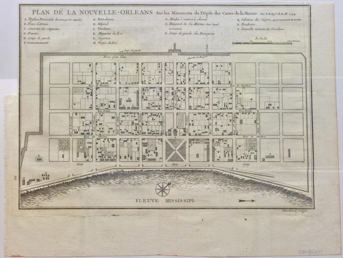 |
Jacques Nicolas Bellin. "Plan
de la Nouvelle-Orleans sur les Manuscrits du
Dépôt des Cartes de la Marine. Par N. B. Ingr.
de la M. 1744." 1744. |
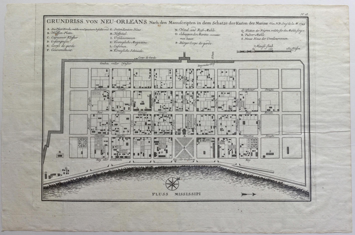 |
Jacques Nicolas Bellin. "GUNDRISS von NEU-ORLEANS
Nach den Manuscripten in dem Schatze der Karten der Marine. van N.B. Ingr. de
la M. 1744." 1756. |
 |
Jacques Nicolas Bellin. "Plan de la Nouvelle Orleans." 1758.
|
 |
Isaac Tirion. "Grondvlakte van Nieuw Orleans, de Hoofdstad van
Louisiana [on sheet with] De Uitloop van de Rivier Missisippi [and] De
Oostelyke ingang van de Missisippi, met een Plan van het Fort, 't welk het
Kanaal beheerscht." 1760. |
 |
R. Benning. "Plan of New Orleans The Capital of Louisiana." 1761. |
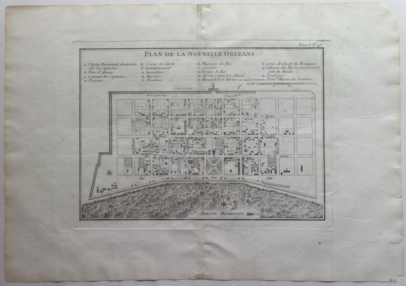 |
Jacques Nicolas Bellin. "Plan de la Nouvelle Orleans." 1764.
|
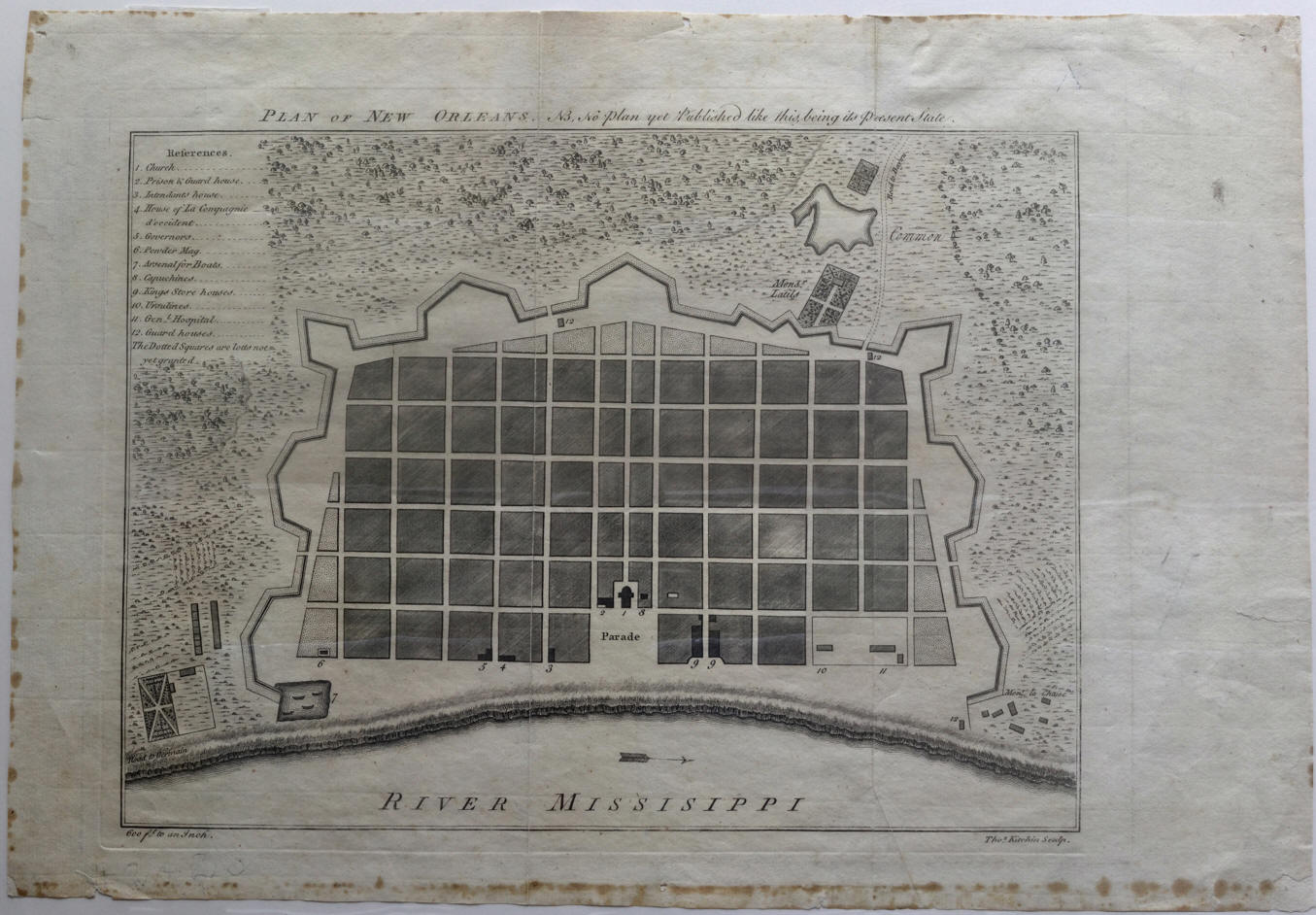 |
Thomas Kitchin. "Plan of New Orleans" 1770. |
 |
John Melish. "New Orleans and adjacent country."
1822. |
 |
Guillaume-Tell Poussin. "Plan du Canal de
jonction du Mississippi au Lac Pontchartrain. [and] Canal de Louisville.
[and] Canal de la Chesapeake a la Delaware." 1834.
|
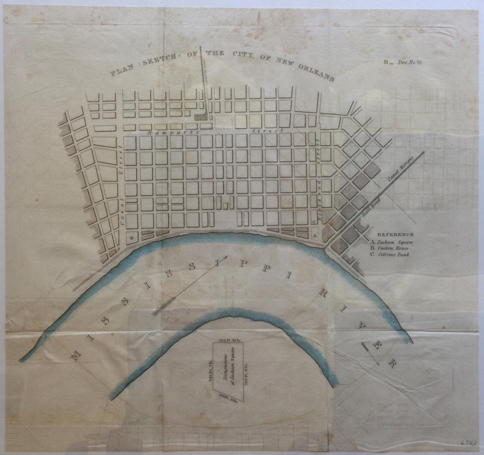 |
[U.S. Government] "Plan (Sketch) of the City of
New Orleans" 1836? |
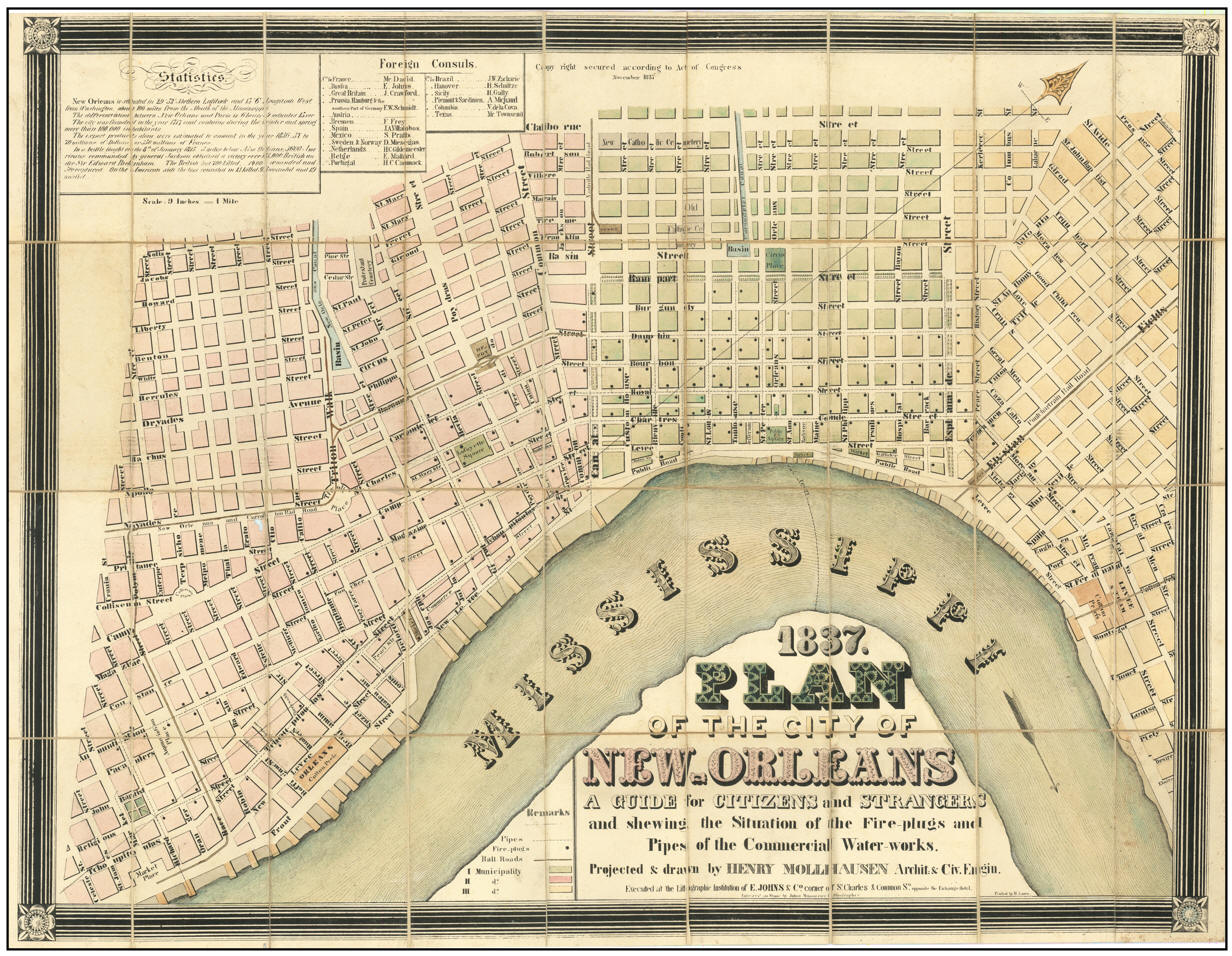 |
*Henry
Mollhausen. "1837 Plan of the City of New Orleans A Guide for Citizens and
Strangers and shewing the Situation of the Fire-plugs and Pipes of the
Commercial Water-works." 1837. |
 |
Thomas G. Bradford. "Washington., [and] Louisville and
Jeffersonville., [and] New Orleans. [and] Cincinnati. 1838. |
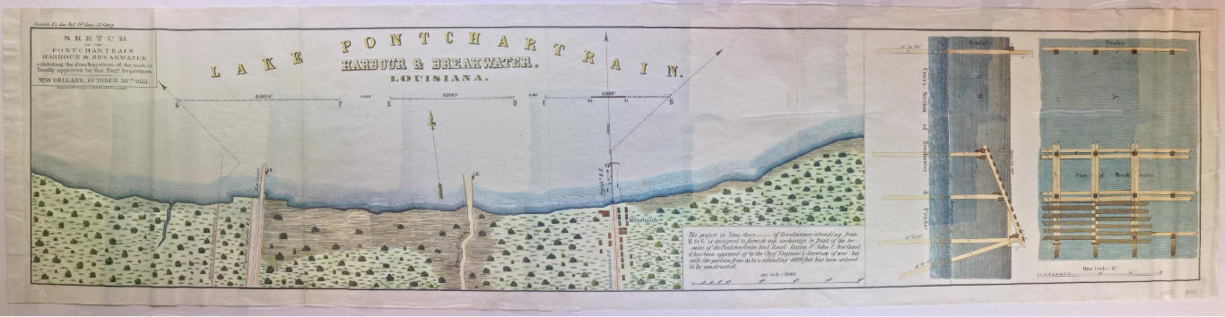 |
U. S. Government, "Sketch of the Pontchatrain
Harbour & Breakwater exhibiting the plan of the work as finally approved by
the
Engr. Department. New Orleans, October 30th
1853." Philadelphia, PA: Wagner & McGuigan, 1853. |
 |
"New Orleans, La. and its Vicinity." 1853. |
 |
Joseph Hutchins
Colton, "The City of Louisville Kentucky [and]
The City of New Orleans Louisiana." 1855. |
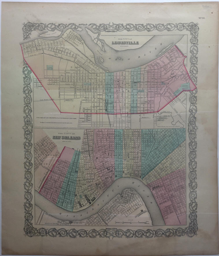 |
J. H. Colton.
"The City of Louisville Kentucky [and] The City of New Orleans Louisiana."
1855. |
 |
"Balloon View of the Vicinity of New Orleans, Looking
toward the Gulf of Mexico." 1862.
|
 |
Frank Leslie.
"Panoramic View of New Orleans, with the National Fleet at anchor in the
River, in front, under command of Flag Officer Farragut, April 25 [1862]—See
page 91" |
 |
S. Augustus Mitchell Jr. "Plan of New
Orleans." 1865. |
 |
"Rand, McNally & Co’s. Indexed Atlas of the World. Map of
New Orleans." 1892.
|
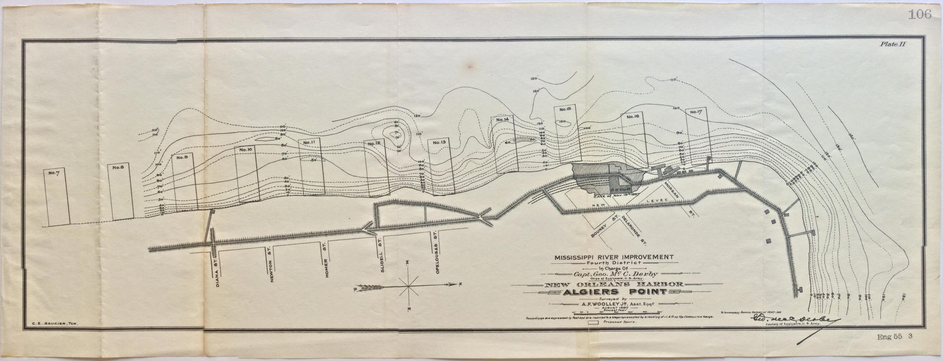 |
Capt. Geo Mc C. Derby (In charge) and A. F.
Wooley Jr. (Asst. Engr). "New Orleans Harbor. Algiers Point." 1897. |
 |
"New Orleans, La. and Mississippi River. Mosaic
by 4th Photo Section Air Service - U. S. Army October 1922."
|
|
|
Capt. Geo Mc C. Derby (In charge) and A. F.
Wooley Jr. (Asst. Engr). "New Orleans Harbor. Algiers Point." 1897. |
 |
Lucile Gillican and Louis Andrews. "Le Vieux Carre de la Nouvelle Orleans
Over a Span of Many Years". 1929. |
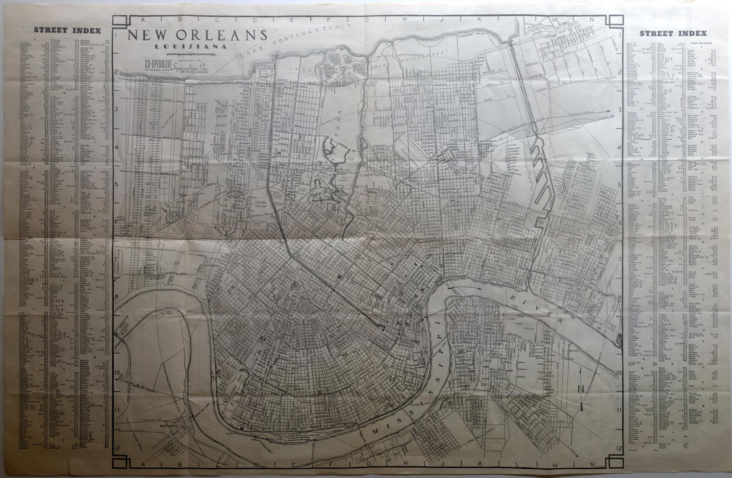 |
W. S. Parks. "New Orleans Louisiana "America's
most interesting City" A City Map with Street Directory. A Guide to Points
of Interest with Facts and Figures about Industry - Agriculture - History -
of New Orleans and Louisiana." New Orleans, LA.: Co-operative Specialties
Inc., [1939]. |
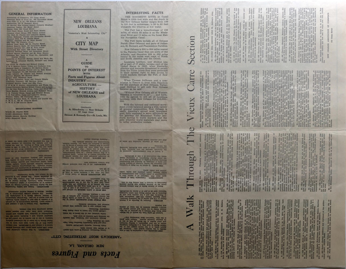 |
Verso left-half rotated to view: folded map cover page and General
Information and Intersting Facts. |
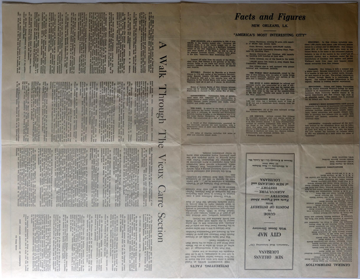 |
Verso left-half rotated to view: Facts and Figures. New Orleans. La.
"America's Most Interesting City" |
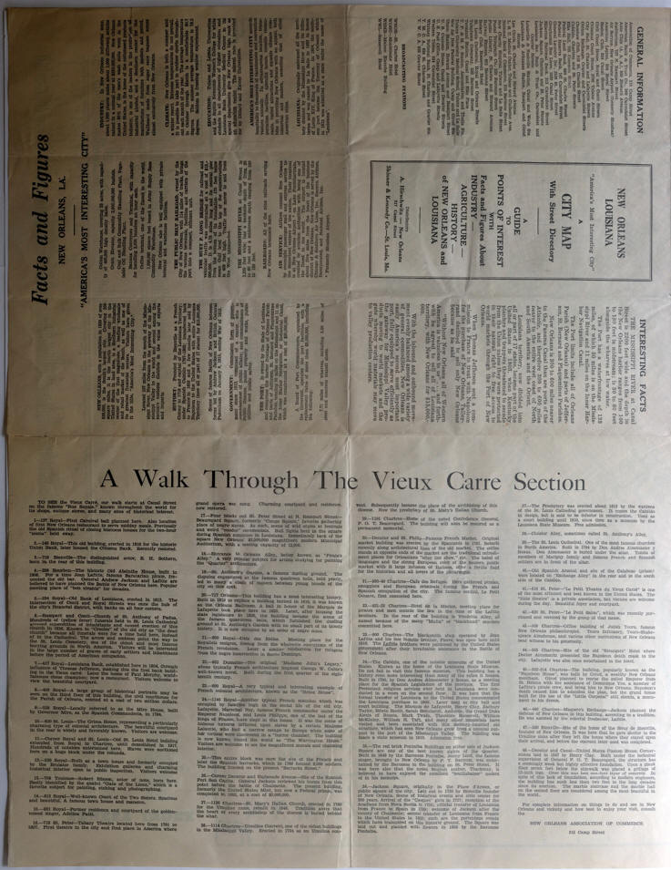 |
Verso left-half rotated to view: A Walk Through the Vieux Carre Section |
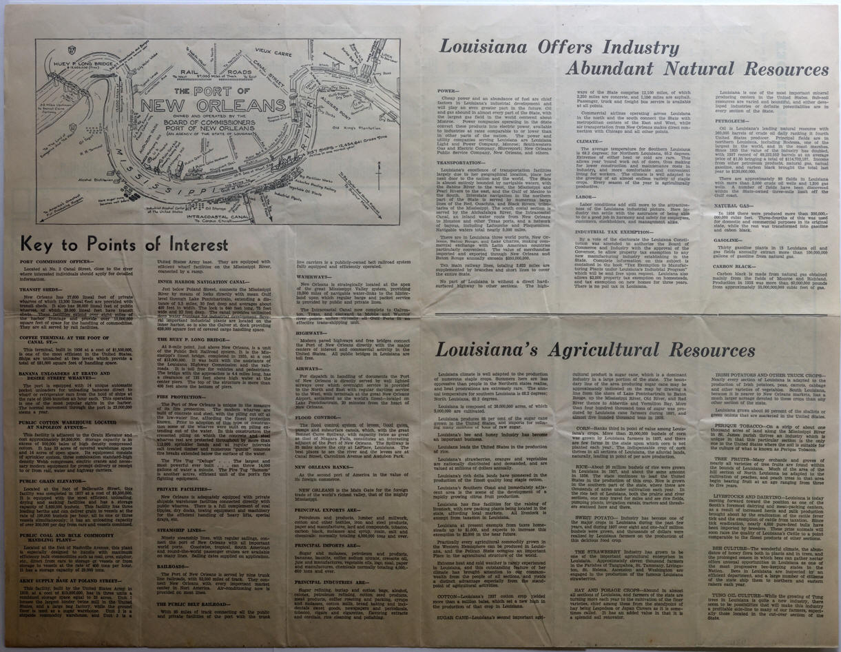 |
Verso right-half rotated to view: Inset map, The Port of New Orleans
with Key to Points of Interest. / Louisiana offers Industry
Abundant Natural Resources. / Louisisana's Agricultural Resources. |
 |
Myra Zimmerman Barnes. "Le Vieux Carre de la Nouvelle Orleans." 1942. |
 |
*Alfred
Waud. "French Market" 1871. The Historic New Orleans Collection, The L. Kemper and Leila
Moore Williams Founders Collection, 1965.
|