|
|
|
Map Library
Louisiana
(Maps marked * are
digital images that have either been purchased from, downloaded from or
linked to
various sources which are credited in the catalog record. Maps not
marked have been digitized from original copies in the buhler-family
library.)
|
Image |
Description |
 |
*Alonso Álvarez de Pineda
"Dibujo
de la costa del golfo de México desde la península de Florida hasta Nombre
de Dios."
1519. |
 |
*Alonso de Santa Cruz.
"Dibujo del golfo de México y costa de Nueva España, desde el cabo de Santa
Elena hasta el río Pánuco." 1544. |

 |
Abraham Ortelius. "Pervviae Avriferæ Regionis
Typvs. Didaco Mendezio auctore." [and] "La Florida. Auctore Hieron.
Chiaves." [and] "Gvastecan Reg." 1609.
(verso) |
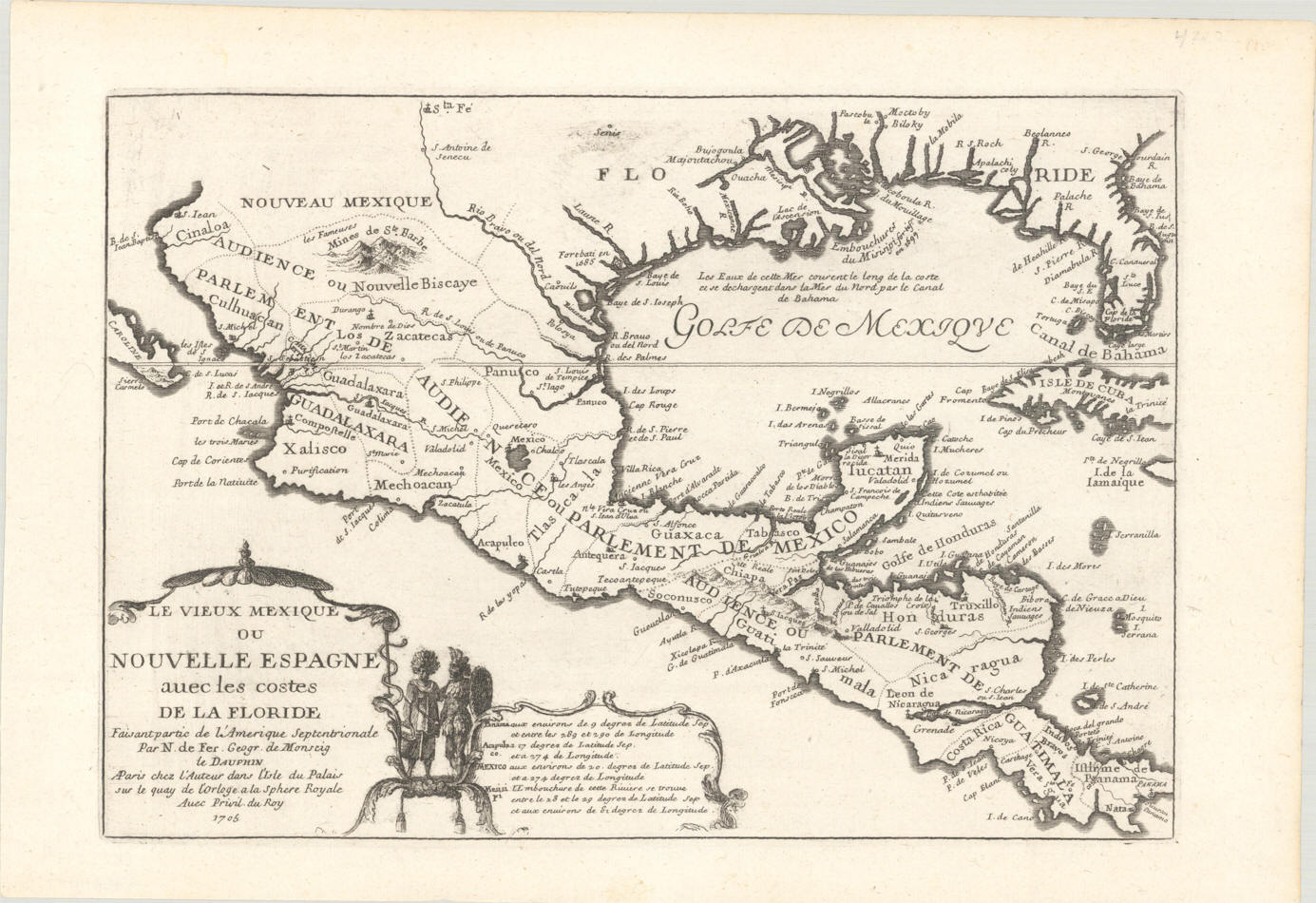 |
De Fer, Nicolas. Le Vieux Mexique ou Nouvelle
Espagne avec les costes de la Floride. Paris: 1705. |
 |
Nicolas De Fer.
"Les Costes Aux Environs De La Riviere De Misisipi Decouvertes par Mr. De
la Salle en 1683, et reconnues par Mr. Le Chevallier d'Iberville en 1698 et
1699. par N. de Fer, Geographe de Monseigneur le Dauphin 1705."
|
 |
Bellin, Jacques Nicolas.
"Carte
de L’Amerique Septentrionale Pour servir a l’Histoire de la Nouvelle France."
1743. |
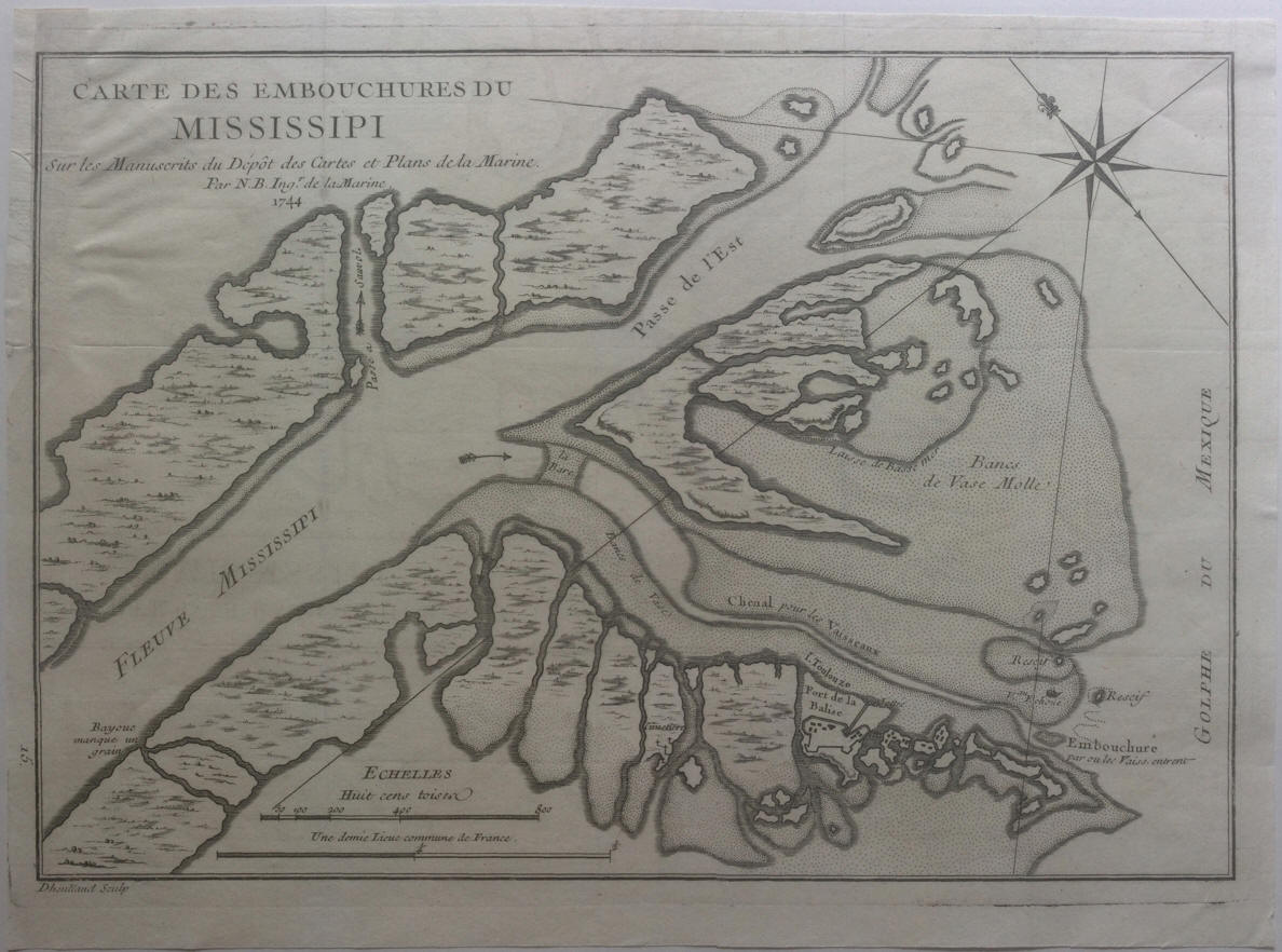 |
Bellin, Jacques Nicolas.
"Carte
des Embouchures du Mississippi sur les Manuscrits du Depot des Cartes et
Plans de la Marine. Par N. B. Ing.r
de la Marine. 1744." |
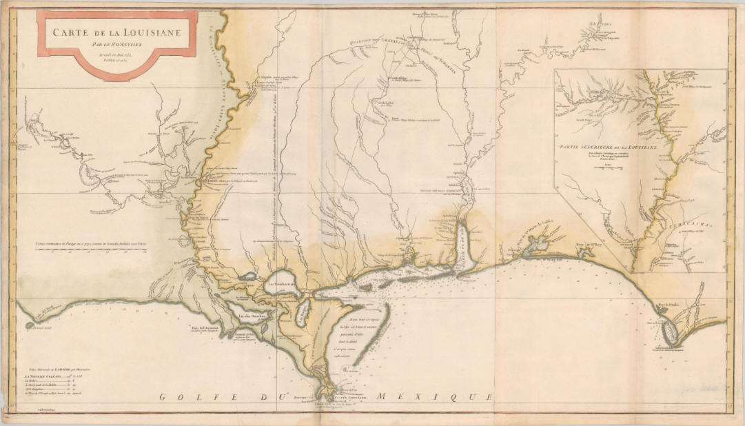 |
D'Anville,
Jean Baptiste Bourguignon, "Carte de la Louisiane. Par le Sr. d'Anville.
Dressee en Mai 1732. Publiee en 1752." Paris, France: J. B. B. d'Anville,
1752. |
 |
Jacques Nicolas Bellin. "Carte de la Louisiane et Pays Voisins pour servir a
l’Histoire Generale des Voyages. Par M. B. Ing. De la Marine.
Paris:
Chez Didot, 1758." |
 |
Thomas Kitchin. "A New Map of the River Mississippi from the Sea to
Bayagoulas." 1761. |
 |
Thomas Kitchin. "A New Map of the River Mississippi from the Sea to
Bayagoulas." 1761. |
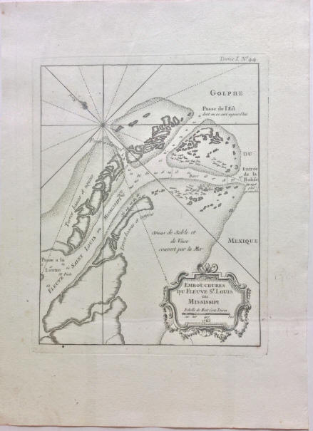 |
Bellin, Jacques Nicolas,
"Embouchures
du Fleuve St. Louis ou Mississipi" Paris, France: J. N. Bellin, 1763. |
 |
Thomas Kitchin.
"Map of the Province of West Florida."
1781. |
 |
Matthew Carey. "Louisiana."
1814. |
 |
H. C. Carey, and I. Lea, "Geographical, Statistical, and
Historical Map of Louisiana." 1822. |
 |
F. Lucas Jr. "Louisiana." 1823. |
 |
Anthony Finley. "Louisiana." 1824.
|
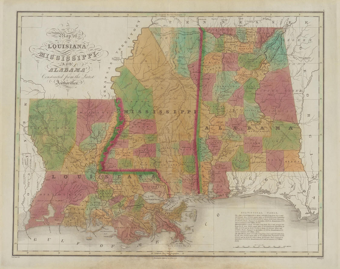 |
Anthony Finley.
"Map of Louisiana Mississippi and Alabama Constructed from the Latest
Authorities." 1826. |
 |
L.T. Hinton and Simpkin & Marshall. "Map of the
States of Mississippi, Louisiana, and the Arkansas Territory" 1832. |
 |
David H.
Burr. "Louisiana" 1834. |
 |
Thomas
G. Bradford. "Louisiana."
1838. |
 |
H. S. Tanner. "A new map of Louisiana with its canals, roads & distances from place to
place, along the stage and steam boat routes by H. S. Tanner." 1839. |
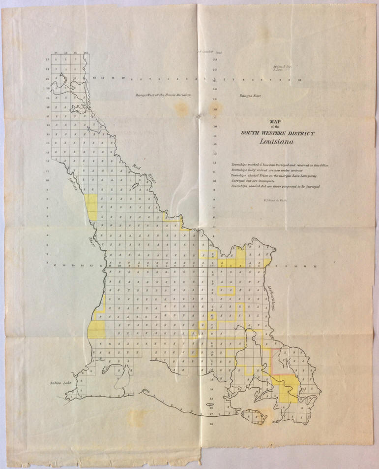 |
H. T. Williams. "Map
of the South Western District Louisiana." 1840. |
 |
H. T. Williams. "Map
of the South Western District Louisiana." 1840.
(2nd copy) |
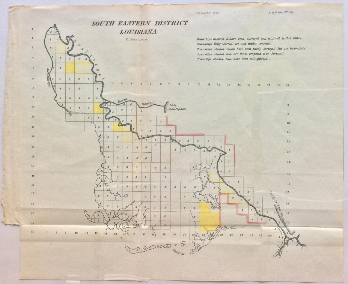 |
H. T. Williams.
"South
Eastern District Louisiana." 1840. |
 |
H. T. Williams.
"South
Eastern District Louisiana." 1840.
(2nd copy) |
 |
H. T. Williams. "Map of the District North of Red
River LA [Louisiana]" 1840. |
 |
[H.
T. Williams]. "St
Helena District La [Louisiana]"
1840. |

 |
Sidney E. Morse and Samuel Breese, "Louisiana."
1842.
(verso) |
 |
Jeremiah Greenleaf. "Louisiana" 1842. |
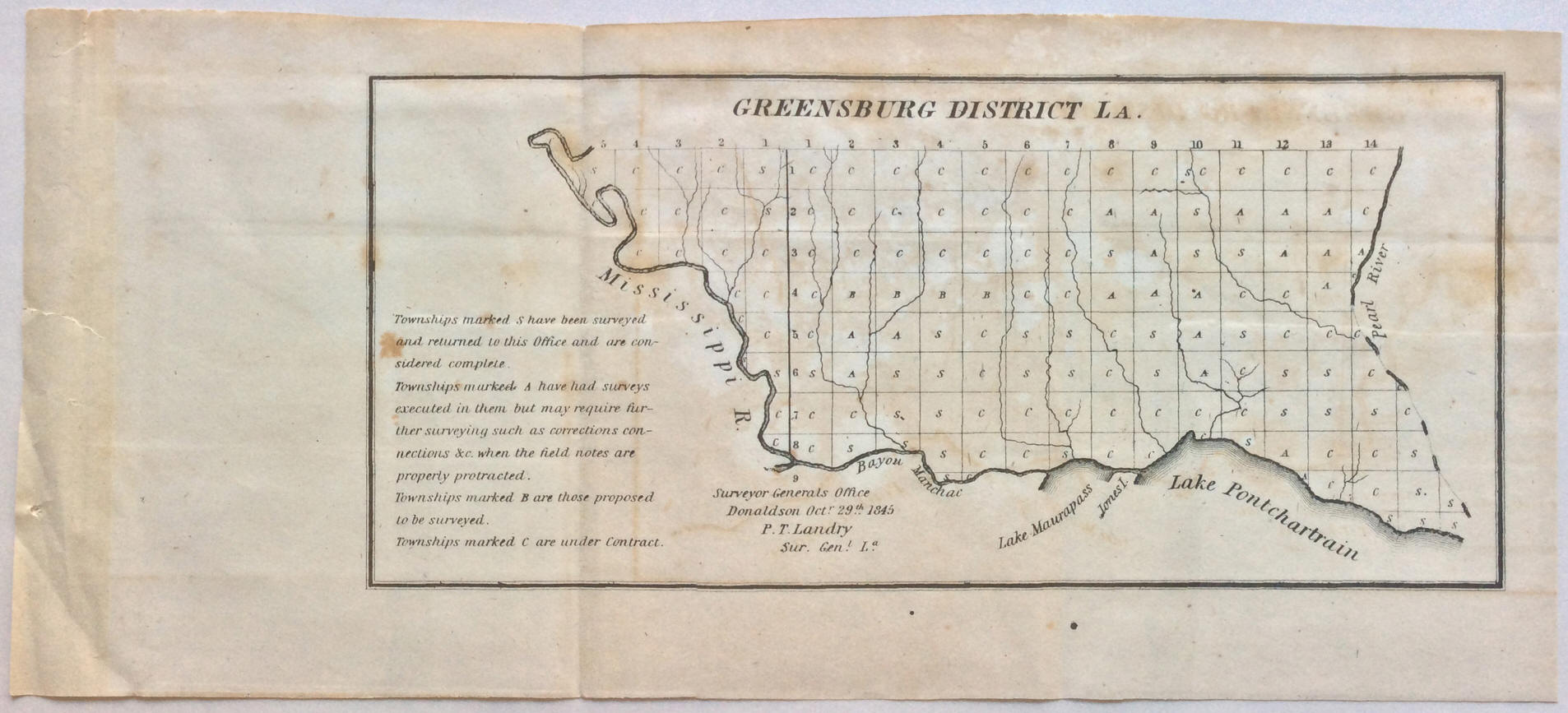 |
P. T. Landry. "Greensburg
District LA." 1845. |
 |
P. T. Landry. "Map of the South Western District
Louisiana" 1845. |
 |
P. T. Landry, "South Eastern District Louisiana"
1845. |
 |
Joseph Meyer, "Neueste Karte von Louisiana mit seinen Canaelen, Strassen,
Eisenbahnen, Entfernungen der Hauptpunkte und Routen fur Dampfschiffe. Nach
den bessten Quellen verbessert, 1845." |
 |
S. Agustus Mitchell.
"A New Map of Louisiana With its Canals, Roads &
Distances from place to place, along the Stage & Steamboat Routes." 1848. |
 |
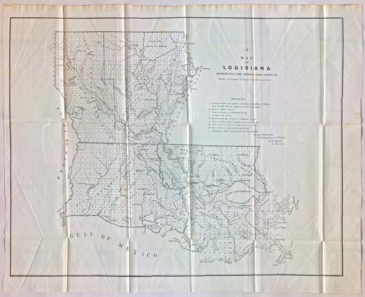
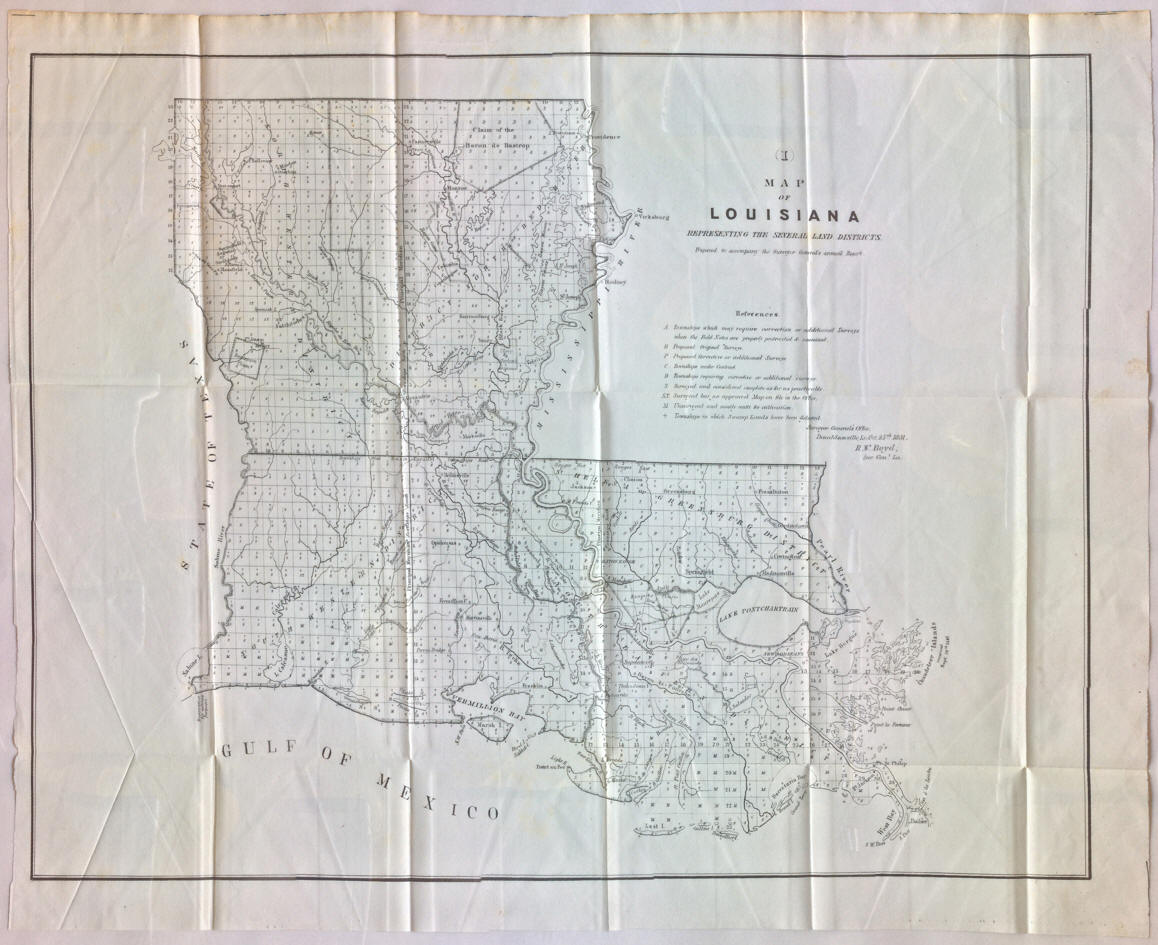
R. W. Boyd. "(I) Map of Louisiana Representing
the Several Land Districts. Prepared to accompany the Surveyor General's
Annual Report." 1849. |
 |
Thomas, Cowperthwait & Co. "A New Map of Louisiana With its Canals, Roads and
Distances from place to place, along the Stage & Steamboat Routes." 1850. |
 |
R. W. Boyd. "(I) Map of Louisiana Representing
the Several Land Districts. Prepared to accompany the Surveyor General's
Annual Report." 1851. |
 |
J. H. Colton. Louisiana. 1854. |
 |
Joseph Hutchins
Colton. "Louisiana." 1855. |
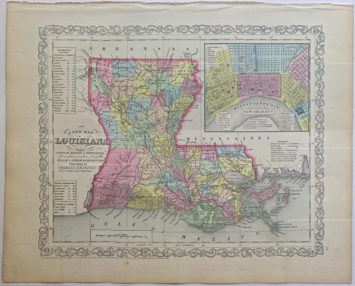 |
Charles Desilver. "A New Map of Louisiana. With
its Canals, Roads & Distances. From place to place, along Stage & Steam Boat
Routes." 1857. |
 |
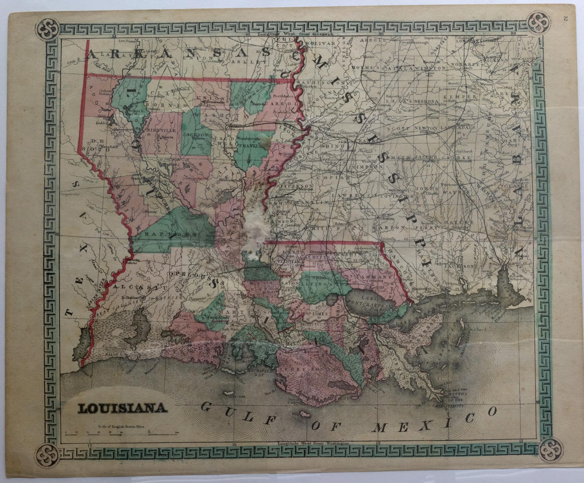
Charles
Colby. "Louisiana" 1859. |
 |
Schonberg & Co. "Louisiana." 1864. |
 |
Ormando Willis Gray. "Louisiana." 1878. |
 |
T. S. Hardee. "Map of Louisiana showing Topographical Features prepared for
the Medical and Surgical Memoirs of Joseph Jones, MD. 1879." |
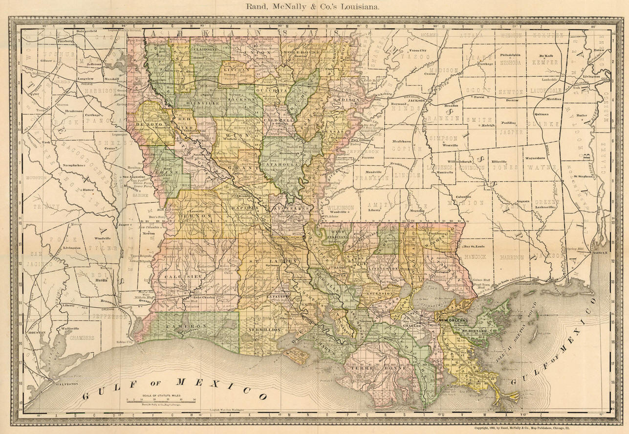 |
Rand, McNally & Co.’s Louisiana. 1882. |
 |
Rand, McNally & Co., Engr’s.
"Map of Louisiana."
New York: Hiram H. Hardesty,
1884. |
 |
Frank A. Gray. "Gray’s New Map of Louisiana." 1893. |
 |
Rand, McNally & Company. "Rand, McNally & Co.’s New 11 x 14 Map of Louisiana." 1895. |
 |
The Century Company. "Louisiana."
1902. |

 |
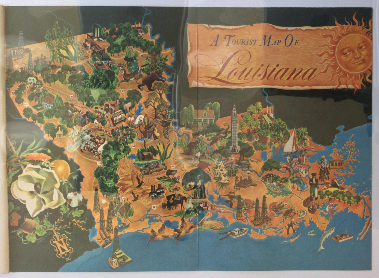
Andry, Margaret Wendt,
A Tourist Map of Louisiana.
circa 1930.
(verso) |
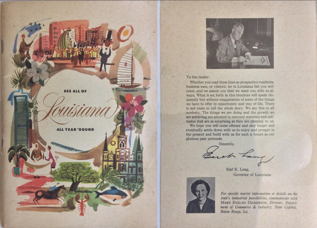 |
Andry, Margaret Wendt,
A Tourist Map of Louisiana.
circa 1930.
From State of Louisiana. See all of Louisisana all year 'round. [Baton
Rouge, LA.]: Louisiana Department of Commerce and Industry, n.d.
(cover of same) |
 |
Gilbert
Grosvenor. "Louisiana Compiled and Drawn in the Cartographic
Section of the National Geographic Society for the National Geographic
Magazine." 1930. |
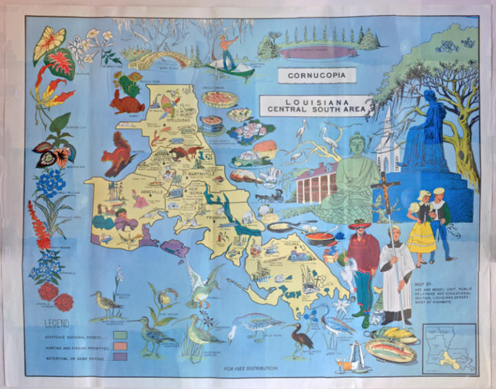 |
Corely, Carl V., "Cornucopia Louisiana
Central South Area" Baton Rouge, LA.: Louisiana Department of
Highways, 1969. |
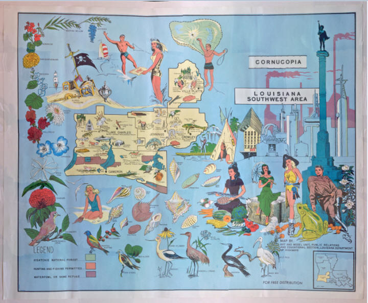 |
Corely, Carl V., "Cornucopia Louisiana
Southwest Area" Baton Rouge, LA.: Louisiana Department of Highways,
1969. |
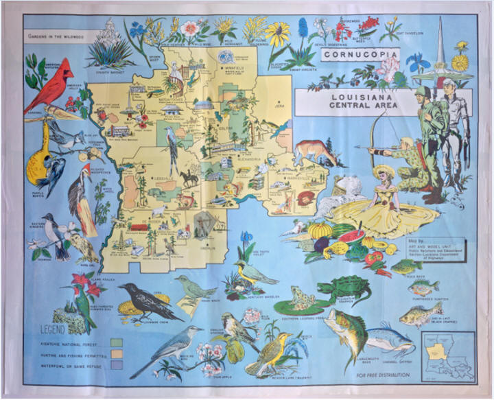 |
Corely, Carl V., "Cornucopia Louisiana
Central Area" Baton Rouge, LA.: Louisiana Department of
Highways, 1969. |
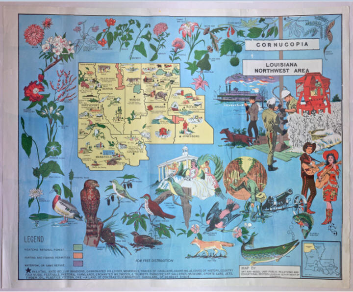 |
Corely, Carl V., "Cornucopia Louisiana
Northwest Area" Baton Rouge, LA.: Louisiana Department of Highways,
1969. |
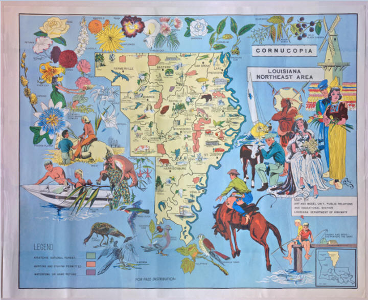 |
Corely, Carl V., "Cornucopia Louisiana Northeast
Area" Baton Rouge, LA.: Louisiana Department of Highways, 1969. |
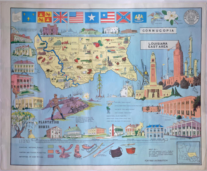 |
Corely, Carl V., "Cornucopia Louisiana East Area"
Baton Rouge, LA.: Louisiana Department of Highways, 1969. |
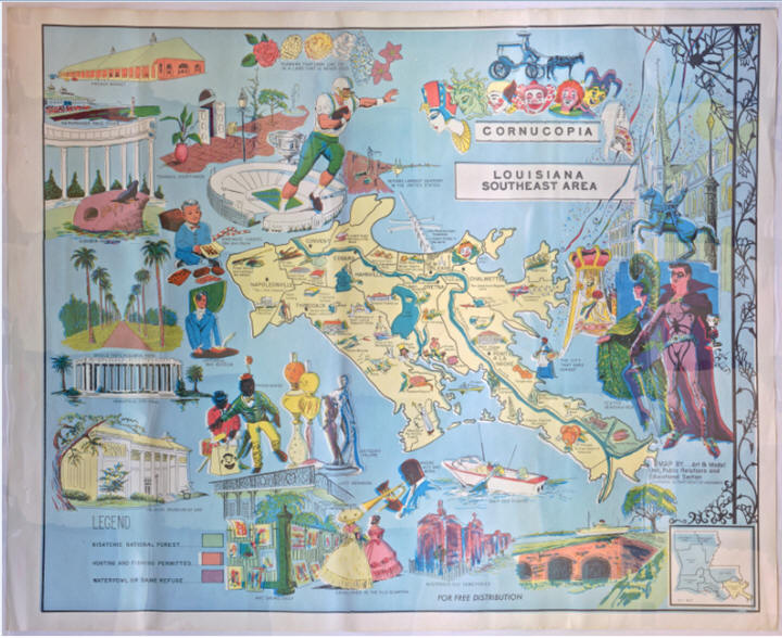 |
Corely, Carl V., "Cornucopia Louisiana Southeast
Area" Baton Rouge, LA.: Louisiana Department of Highways, 1969. |
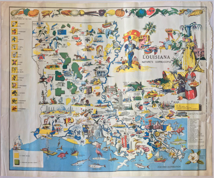 |
Corely, Carl V., "Louisiana Nature’s Cornucopia"
Baton Rouge, LA.: Louisiana Department of Highways, 1969. |
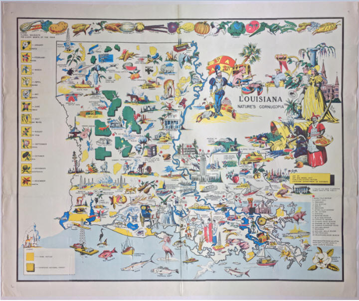 |
Corely, Carl V., "Louisiana Nature’s Cornucopia"
Baton Rouge, LA.: Louisiana Department of Highways, 1969. |
 |
U. S. Geological Survey. "Index to Topographic
Maps of Louisiana." 1980. |
updated 27 December 2025 |
|
